

Waterway Assessments
Waterway Assessments and Mapping
Zulu disaster mapping teams supply crucial data for assessing waterway health, providing quantitative assessments and geo-referenced mapping of affected areas. Assessment and mapping services include still and video imagery and written reports that identify concentrations of large woody debris, obstructions, and that characterize stream channel and riparian conditions of the waterway. Because we also do stream debris removal and streamflow restoration, we know what to look for. We approach every assessment with a “total health” objective. We don’t just take photos of piles of debris, we provide geo-referenced photos and video with coordinate overlays, that are uploaded to our project management portal and provide detailed reports of our findings.
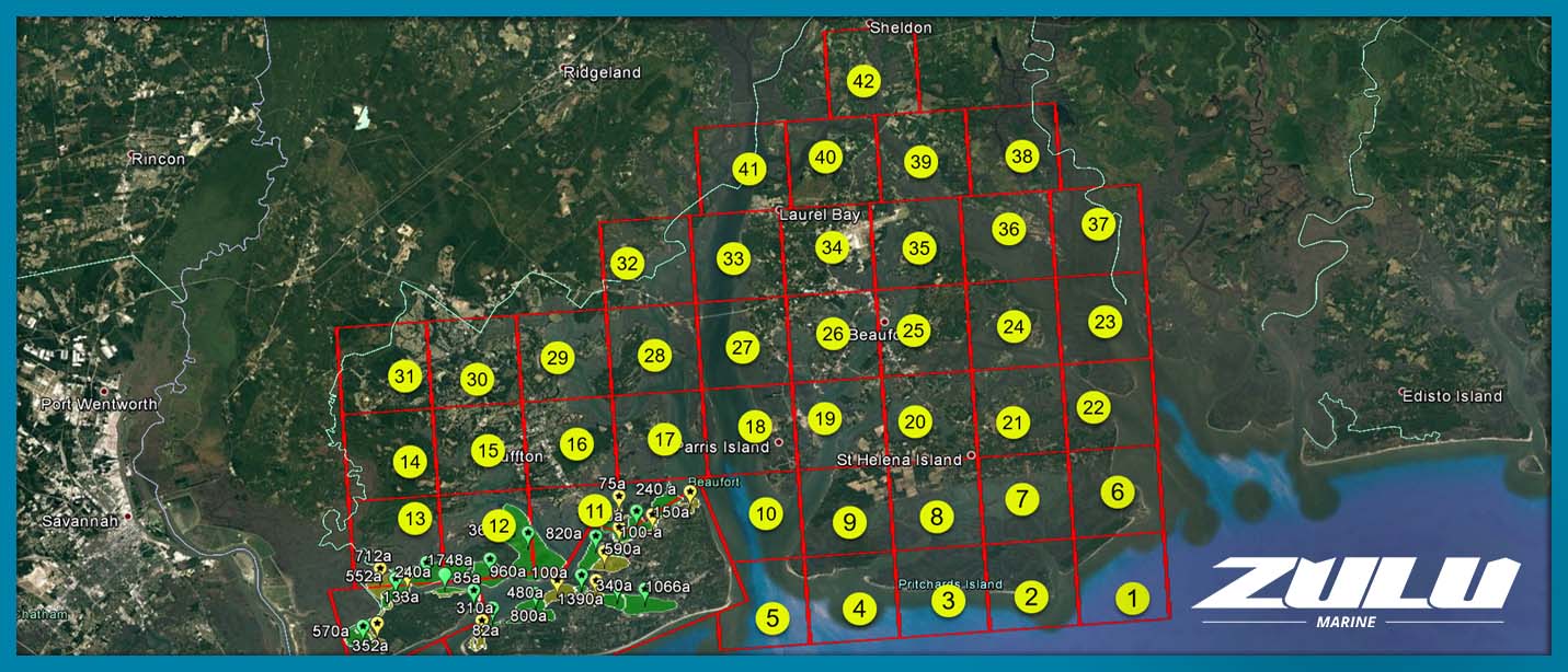
This image shows a grid of 42 search zones that define the assessment area. Each box was a search section flown by UAV to map any debris found. Beaufort County, SC, Hurricane Matthew, 2016
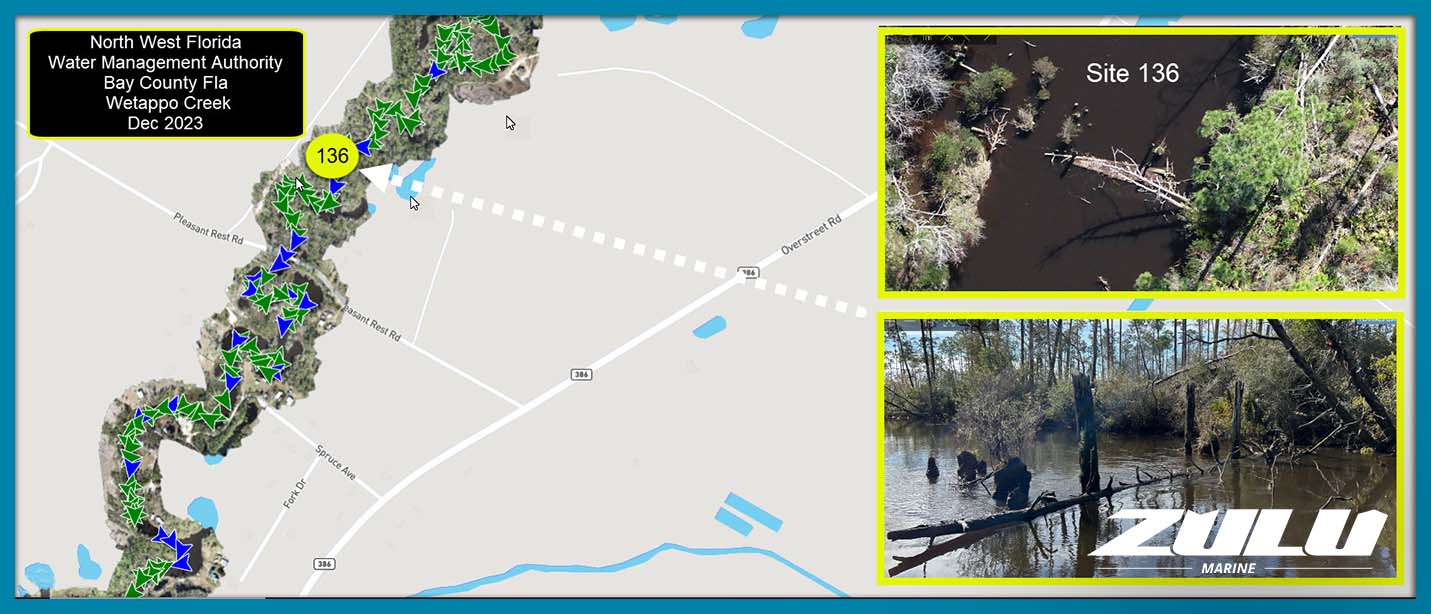
Clicking a map point will pull up images of the debris at that location, making it easy for clients and stakeholders to understand the types of debris and conditions for creating scopes or work or task orders.